
NBC6’s Adam Berg has your forecast for today, Tuesday, June 18, 2024.
This story is no longer being updated. Go here to see the latest information. For the live radar, go here.
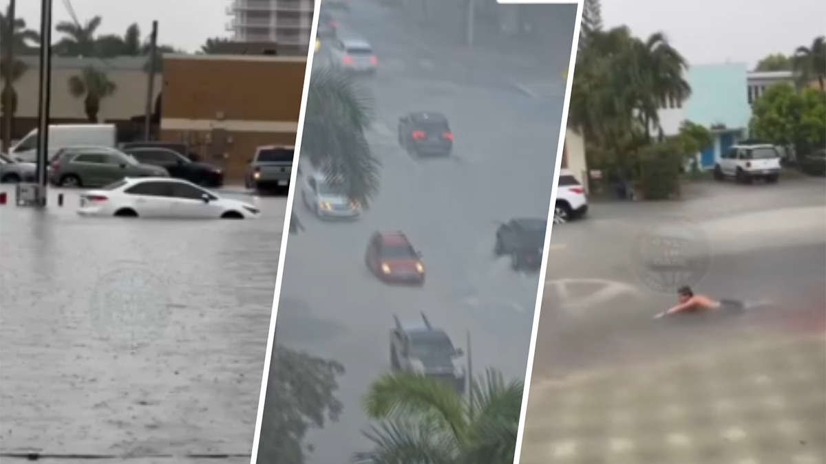
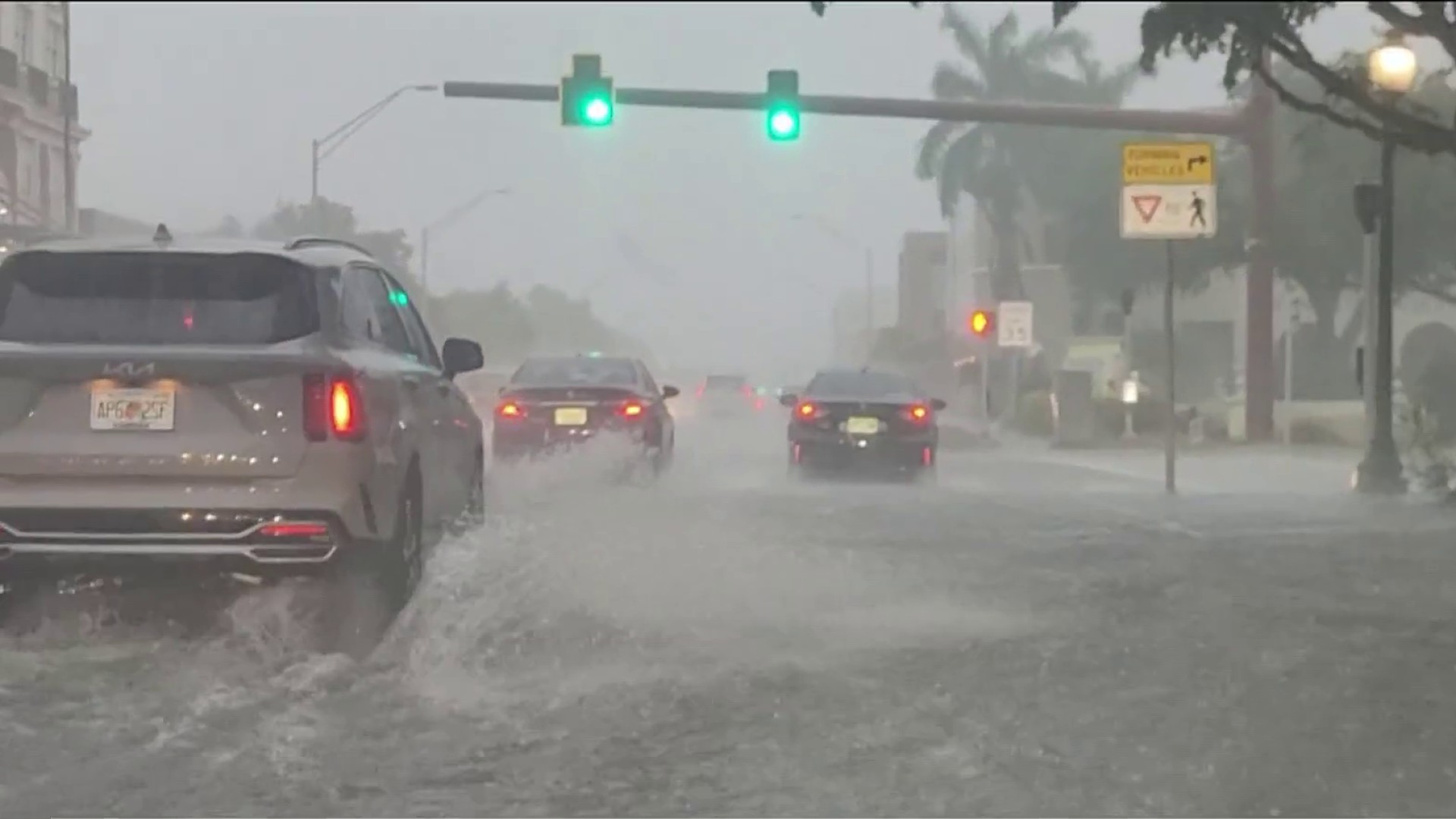
A flash flood emergency and flash flood warnings were issued for parts of Broward and Miami-Dade counties on Wednesday as storms soaked South Florida, causing dangerous widespread flooding.
Watch NBC6 free wherever you are
The flash flood warning was in effect until 8 p.m. and included Miami Gardens, North Miami Beach, Aventura, Fort Lauderdale, Pembroke Pines, Hollywood and Miramar, among other areas, the National Weather Service said.
A rare flash flood emergency was also issued for parts of both counties, initially until 5:30 p.m. before it was extended until 8 p.m. Wednesday, and included areas from Dania Beach down to North Miami and goes from coastal areas to western cities including Miramar, Pembroke Pines, Miami Gardens and Opa-locka.
Get local news you need to know to start your day with NBC 6's News Headlines newsletter.
A severe thunderstorm warning was also issued for a portion of southern Miami-Dade that included Homestead and Princeton and was in effect until it expired at 6:30 p.m.
By 7 p.m. Wednesday, more than 13 inches of rain had fallen in Hollywood Beach, with over 12 inches reported in Surfside. More than 11 inches had fallen in Aventura, while Dania Beach and Fort Lauderdale had received over 10 inches.
After the emergency and flash flood warnings expired, a flood warning remained in place until 8 a.m. Thursday in portions of both counties.
The heavy rain caused widespread flooding across South Florida and even led to the closure of a stretch of Interstate 95 in Broward.
"Life-threatening flooding is now ongoing. Please stay off the roadways and get to higher ground," the NWS said in a post on X earlier in the day.
Tornado warnings were also briefly in effect Wednesday for areas over the Florida Everglades before they expired.
Some storms showed rotation, triggering the tornado warnings.
Tuesday’s tropical rains produced between 3 and 6 inches of rainfall and multiple flash flood warnings in the season’s first significant rain event.
A flood watch also was in effect for all of South Florida and the Florida Keys, as the stage is set for rounds of rainfall that may kick off further flooding. Breezy south winds of 10 to 20 mph are possible.
The flood watch was extended until Thursday evening.


An additional 2 to 4 inches of rain are possible through the day, with downpours likely to continue through Friday.
By the weekend, it’s reasonable some locations could see five-day accumulations of 7 to 10 inches.
This soggy pattern is due to the return of tropical moisture to the region, an element lacking since the South Florida rainy season started on May 15.

In addition, a disturbance will move away from the peninsula Wednesday, dragging moisture behind it.
The National Hurricane Center was giving this feature a 20% chance for development in the western Atlantic over the next several days, far removed from Florida.
Otherwise, local conditions will remain supportive of heavy rainfall through Saturday, with more sunshine and fewer storms expected Sunday.
